For over thirty years
Stapleton was my home. For all sorts of reasons my life revolved around the neighborhood. My mom would go shopping in Stapleton every week and we'd eat lunch at the Woolworth's luncheon counter. I went to the late school at Trinity Lutheran and my first on-the-books job was at the
Stapleton Public Library.
My mother was intimately involved in trying to stave off the ultimate decline of Stapleton through a variety of community groups. She helped found something called the Friends of Stapleton Library but in the end the use of volunteers was limited by the employees union. Then she and the late Helen Pose, among others, invigorated the Stapleton Civic Association. That led to large, annual festivals and flea markets around Tappen Park.
Finally she launched the Stapleton LDC and was its first director. With a staff of three the LDC operated out of Stapleton Village Hall and secured grants for development and struggled to work with the merchants to preserve and encourage commerce in the town. They got the Village Hall refurbished and the gazebo and brick work installed.
All through this period there were lots people taking chances on businesses (ex. Cana's on Broad Street) and buying old homes and renovating them. People like Addison Branch and Cynthia Mailman reminded people of the beauty of Stapleton's architecture. Mud Lane was launched in 1977. The great and definitely not late Norma Herz (superstar children's librarian) brought Peter Seger and the Clearwater to the town on regular visits. There really seemed like some sort of renaissance was happening.
In the end it all sort of came to nothing. Over time the older businesses vanished (think John's Bargain Store, Store of A Million Items, the Army & Navy Stores, etc.) and the new didn't last or were more low end. The SI Mall helped drive a stake through the heart of Stapleton's shopping district just as it did Port Richmond's. But I think the greatest blow to Stapleton was its turning from a working and middle class neighborhood to a disproportionately poor one.
I just read the
Mud Lane Society's history of the decline of Stapleton and it's a fascinating bit of myopia. They make it sound like only the blind eye of bad business killed Stapleton. They claim, though vacant for 13 years, the Piels Brewery could have been turned to some sort of "adaptive reuse" without providing any examples. They claim the Homeport only brought bars without noting that the base never became fully operational and filled with staff and families housed in nearby neighborhoods. High taxes, weak policing and changing economic demographics weren't the culprits according to them, or at least don't merit a mention.
Most importantly they never comment on the Stapleton Housing Projects. Once the City decided to focus on housing for welfare recipients instead of working class and municipal workers Stapleton started on a downward spiral it's never recovered from. Yes, many of the white residents fled because of the appearance of black residents. There's no denying the racism contained in white flight (if you read the SILIVE forums about Stapleton and took a shot at every racist comment regarding how great the neighborhood was you'd kill yourself) but it also holds an element of opposition to one's neighborhood being suddenly changed by influences out of your control. The economic circumstances are different, surely, but look at the reaction of long time residents in Harlem and Bushwick to gentrification.
Still, the problem with housing projects is that they lock an area into a permanent economic stratum. If you deliberately choose to make it the lowest economic one then there's going to be an effect. It's the government saying "This will now be a poor neighborhood forever".
The block bounded by Canal, Cedar, Boyd and Wright - 1917
As the middle-class consumer base that existed for the stores that ran from the top of Broad Street and Van Duzer all the way to Bay Street, along Bay and up Canal and Water Streets shrank the businesses suffered. In the eighties and early nineties drugs and crime helped kill off many that had straggled on by scaring away customers. Do you remember the last time you chose to go to the late Gelgisser's Hardware or Miller Drugs?
Today crime is a much decreased part life in Stapleton (thanks to Giuliani, Bratton and Bloomberg). Even though Woolworth's closed in 1997 (I think), the building has been occupied by the OZ Clothing since about the same time. Other shops appear to be thriving. Security helps lead to economic stability which leads to permanence. Maybe the businesses on Broad Street and along Tappen Park will remain. Maybe future Staten Islanders will be willing to continue taking a risk on Stapleton. Still, it's not enough and old commercial and residential buildings will continue to rot away.
Right to Left - The Rex Theater and neighboring buildings - 1936
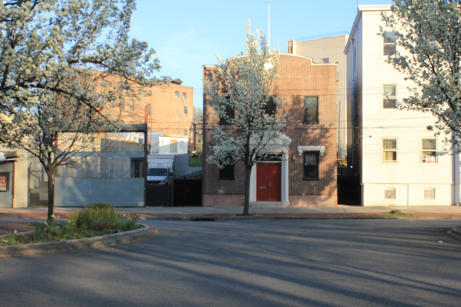
Today it's a nearly empty stretch of grass and trees and the brick sidewalk that were supposed to presage a better tomorrow
Previously the Rex had been the Park Theater - co of Wright and Canal - 1930
Intrepid Development's refurbishing of the old Ross Cosmetics building (I can't remember what was in it before except for Golden Cue Pool Hall {and does anyone have a picture of their old advertisment?} and Wright Toy & Hobby used to be in the back)
172, 176 and 180 Canal Street - 1932 - The brick building at the center is the Baker School of Business - It's not on the 1917 map and 172 is no longer there today.
Same as above - today
160 Canal Street - 1932 - 1898 and 1907 maps list is as being the Hein home
160 Canal Street - today - this wonderfully odd house still stands though, mysteriously, the first floor windows in the front are boarded over.
from right to left - 209 to 232 Canal Street - 1936
215, 217, 219 Canal Street - today - all that remains of the commercial properties that once ranged from Wright Street to Cedar Street on the west side of Canal. The radio shop on the left of the old picture was only recently demolished.
Finally, the centerpiece of the block - The Rubsam & Horrmann Atlantic Brewery. I'm not sure when it was built though a decent portion of the plant is shown on the 1874 map of the area (below).
The top picture (1936) was taken from where Broad and Canal meet looking north toward Wright Street. At the far right you can make out the building in the lower picture (1930) which the maps designates a garage and storage facility. That clock tower forms such a part of my childhood memory. My buddy, Mike G., claimed his older friends had actually climbed up inside of it. Before I got my chance, and based on later exploits I definitely would have tried, it was gone. It was torn down in 1976 when I was ten. Later the city helped build housing much of the site and a park was created on the denuded stretch of Canal Street. It looked derelict then and only more so now.
Canal, Cedar, Boyd and Wright - 2012 - look at the transformation and desolation of the once vibrant commercial and industrial block.


+7-32.jpg)