Showing posts with label West New Brighton. Show all posts

Tuesday, March 26, 2019

High Church - North Shore Episcopalian Churches Pt. 3

Just one church today. The old photos are dark so I decided to include newer shots to accompany each one.

St. Mary's Episcopal Church
On the corner of Castleton and Davis Avenues in West New Brighton, this beautiful little church shares its grounds with a parsonage and garage. Surrounded by medical offices, lawyers, and slightly rundown houses, it looks a little out of place these days. The parish was founded in 1848 and the present building is from 1905. 


Tuesday, July 11, 2017

West New Brighton - Henderson Avenue from Broadway to Alaska Street


I find these blocks of Henderson Avenue pretty interesting. Even though these buildings weren't demolished to make way for the West Brighton Projects, not a single one remains on the block  between Broadway and Chappell, except for the AME church. Presumably, they some were torn down for the construction of Cpl. Thompson Park in the mid-seventies.

On the second block, between Chappell and Alaska, all three buildings remain. The first, Lot 27, has even had a little building built alongside it.


The original A.M.E. Zion Church, now Shiloh A.M.E. Zion Church. It looks as if the present day building was added to and bricked over. Or maybe they just built the brick building on the original foundation.


This building confounds me. It was big, really big, and now it's completely gone. It's not on the 1917 map and now it's completely gone. Corporal Thompson Park was started in the mid-seventies, so how long was this building in existence? Forty, fifty years? It seems strange for such a big building to come and go so shortly. If you have any idea of what it was, please let me know.


Thursday, February 16, 2017

The West Brighton Projects Project: Part Four - Richmond Street, Castleton Avenue, State Street, and Market Street

It's been awhile since I've posted (holidays, new contractor), so here's a great big West New Brighton post. Today, it's only a sidewalk between buildings, but once upon a time a street called Richmond Street ran north from Castleton Avenue between Broadway and Alaska Street. State Street cut across Castleton and ran north for another two blocks before ending at West Union Street, itself a lost street.


This block is an interesting one. Starting from the northwest corner, there's a row of multi-unit buildings followed by a bowling alley/restaurant, then another apartment. 
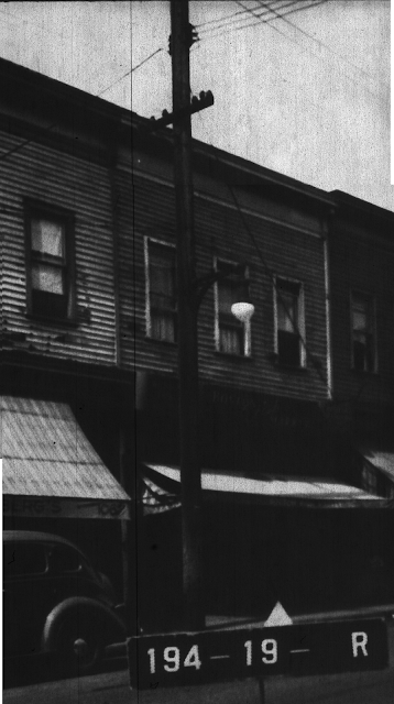
Coming around the corner to Castleton, there's a densely packed block of stores with apartments overhead. It's hard to read all the signs and awnings, but there's an Italian American grocery, a hardware store, a jeweler, and finally a Roulston's. The latter was a widespread grocery chain (about 300 stores in the forties. When its founder died, the family sold off the property).

Looping back around the block, down State Street and around to Market Street, there are two more businesses (the first being a barbershop) and then a run of houses. 

A

B

C

D

E

F

G

Above location seen from same vantage point modern day

H

I

J

K

L

M

N

O

P

Q

R
S


Tuesday, May 03, 2016

The West Brighton Projects Project: Part Two - west side of Broadway between Market and West Union Streets

Moving right along, I've got another West Brighton Projects post. It was a little more complicated to assemble than I thought it would be. If you look at the annotated map you can see most of the property lots in Block 191 have buildings facing both Broadway and State Street. I'm pretty sure the buildings with the actual lot numbers are the ones facing Broadway.

Unfortunately, that leaves me with a batch of buildings with lot numbers that aren't shown on the map. I feel safe in assuming they're the buildings on State Street, but determining the order is proving troublesome. In a case like this, I have to look for clues in the backgrounds and street fixtures to give me a sense of where they should go. In the next post, I'll make my best guess at where they were. 

A

B

C

D

I've always been torn about the City's claim that the neighborhoods it destroyed were blighted, but doing these posts have revealed a significant number of run down buildings as far back as the early forties. I can only imagine what their state was twenty years later when the condemnation proceedings began.

E

F


Thursday, April 07, 2016

The West Brighton Projects Project: Part One - west side of State Street between Market and West Union Streets

While I haven't finished the Stapleton Projects Project yet, I was inspired to start this second Projects Project by a picture posted on Facebook the other day. It was of mass being celebrated in the old St. Benedicta Roman Catholic Church, one of the casualties of the construction of the West Brighton Projects in the early sixties.

I'm swiping the picture, but I highly recommend following this link to the original posting at FB. The poster and several commenters provide some valuable information about the lost neighborhood and the church.

Mass at St. Benedicta


original St. Benedicata ca. 1940 - corner of State and Market Streets


The part of West New Brighton destroyed was smaller than that which was razed in Stapleton. The residences were smaller, and so far, I haven't come across too many big multi-family buildings like in Stapleton. There isn't the commercial-residential mix here either as in Stapleton. The stores appear to have been mostly found out on Castleton Avenue and Broadway.