Thursday, December 30, 2010

Harbor Road revisited

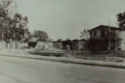
West side of Harbor Road between Leyden and Richmond Terr. - Apr 23, 1932


View Larger MapSame view today

These shots of Harbor Road in Mariners Harbor start with the second house north of Summerfield United Methodist Church. All of the houses shown here are still in existence in one way or another. Let me show you.


Map 1874- The first house in the photo above is that of "Capt.Jones" followed by those of "F. Jones", "Capt. J. Wright", "M. Van Name", and "Capt. Tomlinson". I think I safe assuming that the captains here are oyster captains. A nice indication of the neighborhood's famous past.


View Larger Map
The Capt.Jones house - The porch columns match those in the photo but the railings and beautiful eaves and wood shingling have been removed or covered.


View Larger MapThe F. Jones House - All the beautiful detail has been removed and siding of some sort has covered up the wood shingle. The loss of the porch leaves this house a big blank, unattractive box.


View Larger Map
The first house, that of Capt. Wright, is presently greatly obscured by foliage (so I'm not showing it). You'll have to trust me when I write that the front porches have been removed.

The second, that of M. Van Name (and one of many in the neighborhood), is visible, as is the awful faux-brick asphalt shingle that now covers it. Similar to many of the captains' homes that once lined the Terrace, this house has always been one of my favorite.


View Larger Map
Finally, we have the house of Capt. Tomlinson. It's the most beautifully preserved of this series of houses, though the porch columns have lost their elaborate shapes and are simple four sided columns now and the decorative eaves is gone. Still, the dark trim and curved door is much to my liking.


Well, I suspect this is my last post for 2010. I hope you few readers have enjoyed my pretty slack efforts. I appreciate everyone's comments and I look forward to more feedback and questions in the coming year from everybody.

To everyone, a blessed and happy New Year!

Wednesday, December 29, 2010

Mariners Harbor - how many times is it?

East side of Van Pelt Avenue looking north to the Terrace


View Larger MapSame view (more or less) today - much of the detail appears to have been lost to siding and painting over the decades but it still remains a beautiful house. You can see the large home in the old picture's foreground was torn down and replaced with a smaller one, probably in the 20's.


I keep coming back to Mariners Harbor because it has the greatest collection of surviving old homes (admittedly, since the rape of South Avenue in the 90's, not that many large Victorian piles, and few in perfect condition) on the North Shore. Sure, the preservationists have protected their own homes on St. Paul's and St. Mark's, but for me the real gems are the simple homes tucked away in Mariners Harbor, Stapleton and Port Richmond. These, owned by people often unable to maintain them at all, let alone to the levels demanded by the crazy landmark regulations, are in the greatest danger of being lost.


For me, these houses, some of which date to the earliest part of the 19th century, represent the real woof and warp of life during Staten Island's past. Obviously I'm a sucker for the lost manors and suburban palaces of the Golden Age's magnates, but the places where the working and middle class people lived are my greatest joys. It's much easier for me to imagine, and have some sort of historical empathy for, those families, with their worries and activities.

People like the Stokes, the Vanderbilts and the Camerons lived lives filled with servants and wielded power and wealth beyond anything I'm in regular contact with. The doctors and lawyers, the oyster captains, the clerks, the farmers and brewery workers are the people I'm most interested in. I know, was, and am related to people just like this (okay, well not any oystermen).

These are the people who lost the most with the changes wrought on Staten Island over the past fifty years. Working class neighborhoods were what were destroyed by the advent of the housing projects. The highways that would have crossed Todt and Emerson Hills were stopped but not the one that cut Concord in two. These are the people forced to deal with overcrowded roads and often poorly constructed tract housing.

So that's what interests me and motivates much of what I do here. Don't get me wrong, I do want to know what all those demolished estates looked like, but if I can find more pictures like those on display today I'll be a little bit happier.

Sunday, December 26, 2010

A Staten Island Wedding

I was informed by Mrs. B. about the Museum of New York's photo archives when she sent me the following picture asking if I knew what church it was. I was pretty sure it was St. John's Episcopal in Rosebank. It took a little digging to decide that it absolutely was St. John's. I checked present day images of the church on its own website, looked at the old maps to see if there was a house next to the church in the past (there was; a G.S. Schofield lived there), and finally drove past the church to do one last double check. I was right.

On June 1, 1895, Miss Anne Flemming Cameron, third daughter of Sir Roderick Cameron, married Mr. Belmont Tiffany, grandson of Commodore Matthew C. Perry, at St. John's Episcopal Church in Rosebank, Staten Island. Following the wedding they took carriages to the bride's father's 130-acre country estate in Arrochar, "Clifton Berley".


The Bride's Arrival at St. John's Episcopal Church

A little more digging turned up the following article from the New York Times on May 17, 1895. One of the things I've learned in digging into the history of Staten Island's golden age is that the very wealthy were very well documented.


Above - The Bride's Carriage Returns - Right - The church today


The Bride's Departure


Wedding Reception Photos - presumably this is at "Clifton Berley".

Further research told me that the couple divorced and both outlived their only son, George. Belmont ended up in the papers when he was sued by a widow for failing to live up to his promise to marry her. Mrs. Tiffany became a noted society decorator and decorate the Astor Estate on Bermuda. Later both ended up in the papers again when it seemed their son was arrested for drug addiction and committed to the Bloomingdale Hospital for the Insane.

New Link - The Museum of the City of New York

A new link to the right - the Museum of the City of New York. The assortment of Staten Island pictures is greatly limited but it is a nice selection of things I haven't seen before. Cool, and a generous tip of my hat to the lovely Mrs. B. for brining it to my attention.

Tuesday, December 21, 2010

Anson Phelps Stokes' Mansion


1928 - The Stokes Mansion two years prior to its demolition. A close look reveals a collapsing roof on the sun room in on the center first floor. There's a general look of abandoment to the place.


One of the most elaborate appearing mansions from Staten Island's Golden Age was that of Anson Phelps Stokes. It occupied part of the hillside land between Hamilton Avenue and St. Mark's Place and looked out over the harbor and New Jersey.

With architects, merchant bankers, Episcopal priest and whatnot in their family tree it would be interesting to see where the heirs of this once prominent family have ended up.

The family was clearly very devout, with Anson's grandfather helping to found the
London Missionary Society. Anson Stokes actively supported the American Bible Society, the American Tract Society and the American Peace Society. His son, Anson II, became an Episcopal priest and resident canon at the National Cathedral. His grandson, Anson III, also became an Episcopal priest and eventually the bishop of Episcopal Diocese of Massachusetts.

Caroline Phelps Stokes, one of Anson's sisters, left her estate to the form the Phelps Stokes Fund in order to help improve the housing and education of minorities. Later his other sister, Olivia, used the fund to specifically aid "Negro education". Nowhere on its website does it do more than acknowledge that it was founded by a bequest of Anson's sister Caroline. Her brother Anson and his son the Rev. Anson P. Stokes were both initial trustees of the fund. I wonder if any members of the family have anything to do with the fund at all anymore.


1928 - Same house different vantage point


1874 - The Stokes Mansion and Estate - The heyday of the Island's great estates. To the west is Ladislao de Escoriaza's estate and to
the east that of J.C Green, esq.


1917 - De Escoriza's and Green's mansions are gone, the latter replaced by Curtis High School.


2010 - The only reminder of the Stokes estate is Phelps Place.


1928 - Gate and gatehouse to the Stokes Estate - northside of Hamilton Avenue between Phelps and Egmont


1928 - Gate and gatehouse to the Stokes Estate - northside of Hamilton Avenue looking west from Egmont Place

Wednesday, December 01, 2010

Lost Streets and Homes


The Bayonne Bridge is one of the beautiful municipal structures that remain from a lost golden age. It drive past it several times a week and I'm never not caught by the bold curve of it arch in the day and the patriotic lighting in the night.

But, like many elements of the City's infrastructure its creation came at the cost of homes and pieces of neighborhoods. Going to the maps I set out to see what had vanished in the wake of the bridge's construction in 1928. While no whole heart of a neighborhood was destroyed like with the housing projects in Stapleton, West Brighton and New Brighton, it did result in a giant structure rising like a wall between Elm Park and Port Richmond.


1917 Map - someone helpfully penciled in the bridge's location. Douglas Street is gone and Newark Street half deleted and John Street cut into parts.


Bridge Stanchions Crossing Richmond Terrace
- l. 1931 (Dean Linseed Oil Works in the background)
r. 2010


Below - demolition on the south side of Innis Street - 1928
Bottom - roughly same location - 2010


View Larger Map


There are times when real public needs require drastic changes in landscape. This would seem to safely be one of those times. It never hurts, though, to remember that bridges and highways come at costs more than dollars.


Above - West side of Newark Avenue south of Richmond Terrace - 1928 and 2010


SPECIAL BONUS SHOT - Dean Linseed Oil Works seen from Bayonne

Wednesday, November 24, 2010

L. P. Gratacap and a house I almost bought

Louis P. Gratacap


Before I bought the glorious "Good Prospect" I now live in, I saw several other properties. All were too expensive, entailed the responsibility of being a landlord and in need of way too much repair. The only one I entertained any thought of maybe buying if I wanted to live in probably not so genteel poverty for the rest of my life was on the east side of Bement Avenue just north of Henderson Avenue.


View Larger Map

It's a huge, beautiful 19th century home. It was divided into several units and has an amazing front lawn. Unfortunately, it also had a beautiful side yard that wasn't for sale and had already been subdivided and plans submitted to and accepted by the City's Department of Buildings. You can see the right of two homes that have been subsequently built on that lot.

The imminence of those coming houses right up along the house in question meant there was no way I was going to beggar myself in order to have neighbors looking in my kitchen.


Louis P. Gratacap home - 1924 - circled in red


A recent map tour showed it had belonged to one L.P. Gratacap. An odd sounding name, I immediately googled it and, quickly enough I found out who he was.

Born in Gowanus,New York, Louis P. Gatacarp was the curator of the New York Mineralogical Club and the mineralogy curator at the Museum of Natural History as well. He died, unexpectedly, in 1917 at the age of 67.

Today his once lovely house sits surrounded too closely by newer homes. Still, it stands as reminder of less crowded times on the Island.

Sunday, November 21, 2010

North Shore Staten Island Stuff

The facebook group I created is called North Shore Staten Island Stuff. It's not particularly active at this point, with no one responding to any of the questions I put up and anything. Someday, though, it'll all work.

Thursday, November 18, 2010

My Neighborhood - Cottage Hill

New Brighton around Hamilton Park - 1874


Hamilton Park detail - 1874 - Pritchard House circled in red

Hamilton Park - 1917 Here the Pritchard House is owned by Bertha K. Baker. The only reference I could find regarding her was her membership on the board of the Staten Island Institute of Arts and Sciences from 1907.


I've written at length in the past about Hamilton Park and shown some of the houses that stand where it once stood. Recently my ongoing excavations of the NYPL Digital Collection brought me to this beautiful 1874 map of the HP environs.

I was amazed at the difference in a mere 43 years. The open lawns and gardens of the original Hamilton Park estates and "cottages" are gone by 1917. Some of the original homes are still there (like the Pritchard House at 66 Harvard which remains even today) but their property is greatly depleted and they are coming to be surrounded by newer, smaller homes.


View Larger Map

66 Harvard Avenue - Pritchard House - the wooded back yard on the house's west side used to be a lawn looking out over at the fields and farms of New Jersey. Today its enclosed with a giant hedge and overgrown.


The difference between 1917 and 2010 is less noticeable. The big estates were already broken up in 1917. There were new homes built, but aside from the large estate of Domenico Rorengo (no reference found) and several other larger houses on Buchanan Avenue, any tear downs aren't immediately apparent. I guess most of the cottages came down in that 1874-1917 period.

Hamilton Park - 2010


This is a closeup of the Stebbins property at the north of the Hamilton Park development property. HG Stebbins was a War Democrat, congressman and later the president of the NY Stock Exchange. His estate, which I don't presently have a picture of, was described as castlelike and crenelated. By 1917 it was all gone, as were many of the neighboring mansions to the north along Richmond Terrace.


As usual Forgotten New York has already covered the neighborhood and provided more and much better pictures than I've ever put up. Thanks for making me feel small ;)

Thursday, November 04, 2010

Easy, Breezy (Port) Richmond Avenue


NE corner of Vreeland and Castelton, summer 1936


View Larger Map


I've been working on some elaborate posts using the 1874 maps of my neighborhood and some picture scans but I'm not getting it done. So...here are some easy to slap together shots of the beautiful Port Richmond commercial and residential strip of the distant past versus its fairly rundown and sad looking present.


NW corner of Harrison and Richmond Avenue - 1929 - Perhaps the most iconic Port Richmond commercial image. In my youth this corner building was still in god shape. It's what still jumps to mind (alongside the Reformed Church) when I first think of Port Richmond.


View Larger Map


Like some many other long time Islanders I grew up shopping in Port Richmond on a regular basis. since we didn't drive we'd hop onto the #3 bus in front of SI Hospital at Castleton and Cebra and get off on Richmond Avenue. There were five a dime stores, discount stores, hobby stores, clothing stores and the Luggage Shoppe. The last was one of the first stores to move off of the Richmond Avenue strip. They moved to New Dorp Lane and only closed in the past year or so.


The Ritz Theater and neighboring shops - 1930 - The movie playing was "Sunny Side Up", a musical from 1929 starring Janet Gaynor.


View Larger Map


The JC Penney's Plaza on Forest Avenue went a long way to killing Port Richmond but the Mall's advent in 1973 spelled it's final death. It lingered on for the next two decades and some of the old stores actually remain (Merlino's Photo Studio, Brownies Hobby Shop, and the oft referenced Tirone's Shoes only just closed).

But the big discount and five and dimes closed up. There was an effort by the Port Richmond LDC to encourage furniture stores to move in to the vacant stores and that helped a little but the whole neighborhood of churches, apartments and nice homes fell into a slowly, grinding disrepair. Even today, with Mexican shops replacing the old ones, the shine has never been restored to the avenue. Beautiful facades have been covered up, windows are blocked up with cheap looking advertisements and trash flutters along down the sidewalks.


Richmond Avenue, south from Hatfield Place, c. 1910


View Larger Map

Today the beautiful home on the left corner is gone but behind trees the one to its left remains, obscured somewhat by trees.

Port Richmond was in the news a lot this past summer because of supposed racial incidents between the Mexican and black residents of the northern part of the neighborhood. While there's been longstanding tensions between the two communitiesnThe coverage in the news was woefully inadequate and often misleading.

A group called "Make the Road New York" claims the neighborhood is predominantly black and Hispanic and has an income level of around $19,000. This is only true is you restrict Port Richmond to the space between Heberton and Nicholas and Castelton and the Terrace. Most of the "racial" incidents were simple thuggery and thievery. Instead of simply addressing the straightforward law enforcement needs of the neighborhood it was turned into a circus for the likes of the Mexican consul to grandstand.

Thursday, October 21, 2010

New York Shoe Market - in the heart of the heart of West New Brighton


sw corner of Caroline and Castleton, c. 1927 You can see that the no longer extant fake mansard roof and gables was already decaying.

As I've written about several times previously, the site of the West Brighton Projects was once a diverse and complete district unto itself. There were movie theaters (including the first ever on Staten Island) on Castleton and Broadway. a factory filled the land now later turned into Cpl. Thompson Park. There were tenements, houses, churches, and of course stores. Decent stores, not just scuzzy delis and 99 cent stores. Tompkins Department Store was on Castleton only a few blocks from Broadway. Now, the residential heart of the area bounded by Castleton, Broadway, Henderson and Alaska has been long replaced with anthill like housing projects and the theaters are long, long gone.

The buildings that once housed the stores and theaters remain, repurposed and often run to seed. But they are still there and a little squinting can bring up images of a time most of us walking there today can't quite believe ever was.

Today's building is listed on the map as belonging to James Butler. The info tag indicates that the James Butler store in the picture is one of several.

I'm more interested in the left side of the building and the cheap, quality shoes it has on offer.
I like the image of the woman passing by and stopping and debating the quality and necessity of the shoes on display and contemplating if she's got the $2 or $3 she'd have to spend on them.


You can just make out the words on the truck's side: New York Shoe Store


View Larger Map

The building, owned by a community group called "Heritage House", for a long time, was allowed to fall deep into decay and now sits marked with the dread boxed X indicating it's not to be saved in case of a fire.

Tuesday, October 12, 2010

A Park Fit for Heroes


Hero Park was built on land donated by Dr. Louis and Berta Dreyfus back in 1920. The centerpiece of the park was (and still is) the glacial Sugar Loaf boulder and its plaques commemorating the 144 Staten Islanders who died in the First World War.

Dr. Dreyfus(whose house I posted about in the past) had invented a process for manufacturing chewing gum base in 1909 had become fairly wealthy as a result. He founded the L.A. Dreyfus Company in Clifton in 1909. Dr. Dreyfus died quite unexpectedly in 1920 at the age of 52. He was about to give a speech at the opening of the new trolley line in St. George when he suffered a heart attack, fell into the arms of Msgr. Cassidy of St. Peter's and was taken off the stage as the Police Band broke into the Star Spangled Banner.

Dr. Dreyfus' widow, Berta, donated thousands of dollars to numerous churches and charities over the years. In return she got IS 49 named after her. Woo hoo! When she died it was clearly a notable event. Even Mayor LaGuardia came to her funeral.

(r. to l. Pastor Carl Sutter, Mayor Fiorello LaGuardia)


Hero Park was the park my friends and I went to go sledding at when Silver Lake was too much effort and where we played football on a the same ridiculously sloped area along Victory Boulevard.

Often it was just a place to hang out. When I was younger I had heard tales of "older kids", mostly the brothers of my friends, having keg parties up in the wooded patch near Howard Avenue. The cops might show up, make sure they weren't too loud, and then roll by for a beer before going off duty. By the time I was old enough for keg parties the cops weren't that accommodating anymore.

My time just hanging out at Hero Park was spent mostly around and on the Sugar Loaf boulder. With its eagle topped plaque it was a striking focal point of the park. When the plaques started vanishing we were all dismayed. In recent years the Friends of Hero Park have helped refurbish the park and replaced the missing plaques.


View Larger Map

I tried to track down whatever happened to Dr. Dreyfus' company and finally found out in an article on the Free Library site. After Dreyfus' death the firm continued to grow. In 1935 it became a wholly-owned subsidiary of Wrigley and in 1949 it outgrew its home base and moved to Edison, NJ. In 2005 Wrigley, in order to survive, consolidated its gum base production in Georgia and closed the Edison plant. There are some touching words about how grateful they were for the LA Dreyfus plant's employees' dedication over the decades but business being what it is it was time for a change.

North Shore Staten Island Stuff

So I started a facebook group called "North Shore Staten Island Stuff" in order to get the Ape word out to more people. I admit to a little bit of jealousy when I saw the cool looking site and connectivity on the Secret Staten Island site.

Of course that's just silly. It's a nice looking site and they've had the foresight to use social media to get more people involved. It's also a different sort of site than "Ape Shall Not Kill Ape". It's much more direct and inclusive than ASNKA and it's set up to encourage reader input and participation. Mine's still an idiosyncratic blog dedicated to my own peculiar interests and the North Shore specifically. SSI is dedicated to covering the entire Island and they look like they're doing a great job.

So, I've started a facebook group for ASNKA and I hope it gets more people involved and puts me into more contact with people with the information I'm looking for.

Saturday, October 09, 2010

Asbury African M.E. Churchyard


A recent first time visit to Meislohn-Silvie Funeral Home the other day got me to looking around at the Pathmark plaza and the tangle of streets behind that testament to grubbiness. I started thinking about the tangle of streets behind it (Lexington, etc.) and I trying to picture what it all looked like once. So I turned to the trusty 1917 maps I've been using.
I'll do more digging later but right now the thing that caught my immediate attention was the "African Ch. Cemetery". It was on forest Avenue between Linden (now Eldgridge) Avenue and Livermore Avenue. Now if my increasingly spotty memory serves me right that where Osaka and the new 7-11 are located.
A quick visit to tremendously helpful Friends of Abandoned Cemeteries Staten Island site filled me on this lost graveyard. Apparently, while never officially registered with the city as a cemetery, the property was owned by the Second Asbury (Zion) African Methodist Episcopoal (AME) Church and used for burials.
By 1913 there were no standing headstones and by 1980 when developers who'd bought it from the city dug it up they claimed no bodies were found. My cynicism makes me immediately doubt this claim.
So the next time you get a bag of chips or some sushi think about the the bodies of ex-slaves and their relatives probably lying under your feet. Ah, commerce.


View Larger Map

Request

I'm always (sort of) on the lookout for postable stuff, information and above all photos. In particular I'm looking for pictures from the seventies and early eighties of commercial sites and of the North Shore specifically. If you or anyone you know had anything like that and might be willing to share it with me please let me know. Thanks.

Tuesday, October 05, 2010

Horrmann Castle


High atop a hill in Eldorado, or at least Grymes Hill, Staten Island, stood a castle. A wonderful castle built by beer and with German whimsy. For decades it towered over the brewery owned by its builder and the Stapleton homes of its owners employees.

Later it became a convent and eventually burned down. When I was young its site had become a wooded cliffside where stolen cars were dumped. I know some of the tiles from its ruins had been rescued by the Olsens, a family with their own beautiful home nearby. Today its beautiful vantage point overlooking the now decrepit Stapleton neighborhood is occupied by a series of fairly typical Staten Island mansions at the end of their own little gated private road.

CORRECTION - In the comments, someone kindly told me this did not burn. Instead, it was simply demolished.


View Larger Map

Thursday, September 16, 2010

Another Business Gone the Dodo Way

The intersection of Port Richmond Avenue and Richmond Terrace is a place I've gone to for pictures and postings several times before. I keep finding new (old) vantage points it's been shown from and it keeps fitting into new ideas for posting topics.


July 1, 1929 - In the front, the Port Richmond National Bank, followed by the Staten Island National Bank and Trust Company


View Larger Map

Upon the slightest bit of research I discovered that the two banks are really one. In 1902 the Port Richmond National Bank was founded and in 1926 it renamed itself the Staten Island National Bank and Trust Company. It ceased to exist when it was acquired by Chase in 1957.

April, 1930 - Looking north along Port Richmond Avenue at the two banks from alongside the Dutch Reformed Church's cemetery


View Larger Map


April, 1930 - A close up of the Staten Island National Bank and Trust Company


View Larger Map

If you see the bank from Richmond Terrace you can see where a teller booth for cars was added in what I imagine was an effort to modernize the bank and attempt to keep it going as foot traffic died on Port Richmond Avenue in the late seventies. In the google picture there's a black van parked in the old drivethru and the booth is the low building to the van's right.


View Larger Map

Tuesday, September 14, 2010

Back to Business

I've been away for awhile. The luminous Mrs. V and I took and extended road trip west through Ontario and America's northern tier to Glacier National Park in Montana. I strongly recommend it to anyone with the slightest interest in seeing some of the country's most beautiful places.


In an effort to work something in with the heading I'd already come up with I glommed some pictures (the usual then/now sort of things) of businesses that are no longer with us even if the skeletal remains of their structures linger on in some reconfigured fashion. They reflect a pre-mall/shopping plaza era when the businesses people frequented were only a close walk, or at worst, a short bus ride away. While I miss the personal quirks of small, neighborhood stores, their higher prices and smaller selections make me not miss them that much.


View Larger Map
Canal Street, Stapleton 10/04/36 - north of Broad Street


View Larger Map

The foot of Victory Boulevard looking west from Bay Street, Tompkinsville - 11/08/33


View Larger Map

Morningstar and Innis, Elm Park - 3/24/28 - The curved section of the cornice on the building in the center reads "Bodine's Big Store".

More to come.......