Showing posts with label Victory Boulevard. Show all posts

Tuesday, June 14, 2022

Lost Apartments of the North Shore: the Baltimore Flats


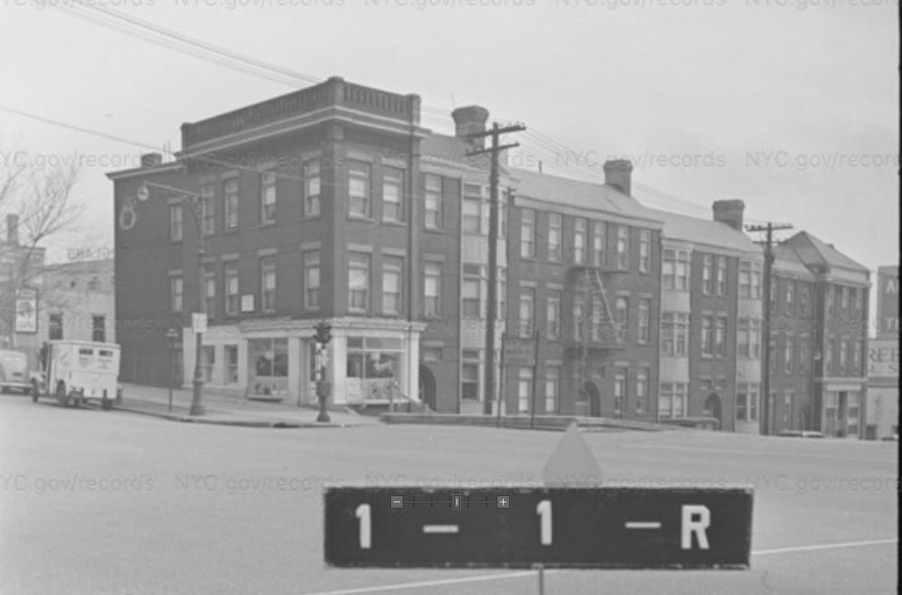
17-23 Victory Blvd, ca. 1940

When my parents got married, they lived at 115 Stuyvesant Place. It's where I lived my first three years. They bought a house on Cebra Avenue when their rent went up to $137 and exceeded a mortgage. As a baby, my mom and I went to all sorts of stores in St. George and Tompkinsville. I had memories of eating in a luncheonette at the corner of Victory and  Bay, but I couldn't remember anything specific about it except that my mom was friends with a waitress. It was only doing some research a few years ago that I discovered pictures of it.

The luncheonette was called DeFranco's and it was in the corner of a string of apartments called the Baltimore Flats. They're a beautiful example of late 19th-century buildings, designed by Edward A. Sargent. Unfortunately, after part of them caught fire in 1980, it wasn't long before the entire block of flats was demolished.


DeFranco's Luncheonette, 1969 - My mom and I could be inside 


Baltimore Flats on fire - 1980


the Baltimore Flats, 1980 - awaiting their fate


1989 - rubble


2021

Lost Apartments of the North Shore: 210 Victory Boulevard


                                                            210 Victory Boulevard, ca. 1940


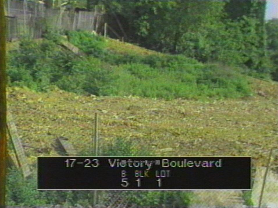
   I have only the slightest memories of this building, even though I grew up a few blocks away and probably walked past it hundreds of times before it was torn down in the early 2000s. I suspect the reason it never really registered in my mind is because it was set way back from Victory Boulevard and the property was no longer the nicely-maintained lawns and hedges depicted above, but a mass of uncontrolled trees and bushes. 

   When I was a kid, those set-back buildings had acquired a reputation for housing shady characters. A friend of mine lived in one of them - maybe even this one - and I visited once, and it was fairly creepy. 

   According to Dept. of Building records, in 2000, it was reported that the back of the building had collapsed and the front was in imminent danger of coming down. I've always been fascinated about the circumstances by which a perfectly decent building reaches a state where it's abandoned and left to ruin. Whole families lived there once. Hopes were hoped, dreams dreamed, and lives lived inside those walls. Now, it's not much more than a few photos. As such, I'm going to do a series of short posts about buildings similar to this one that once graced our streets and at some point - poof!- just seemed to vanish into the æther.

2013

1917 map


1996 NYC aerial map


Tuesday, October 12, 2010

A Park Fit for Heroes


Hero Park was built on land donated by Dr. Louis and Berta Dreyfus back in 1920. The centerpiece of the park was (and still is) the glacial Sugar Loaf boulder and its plaques commemorating the 144 Staten Islanders who died in the First World War.

Dr. Dreyfus(whose house I posted about in the past) had invented a process for manufacturing chewing gum base in 1909 had become fairly wealthy as a result. He founded the L.A. Dreyfus Company in Clifton in 1909. Dr. Dreyfus died quite unexpectedly in 1920 at the age of 52. He was about to give a speech at the opening of the new trolley line in St. George when he suffered a heart attack, fell into the arms of Msgr. Cassidy of St. Peter's and was taken off the stage as the Police Band broke into the Star Spangled Banner.

Dr. Dreyfus' widow, Berta, donated thousands of dollars to numerous churches and charities over the years. In return she got IS 49 named after her. Woo hoo! When she died it was clearly a notable event. Even Mayor LaGuardia came to her funeral.

(r. to l. Pastor Carl Sutter, Mayor Fiorello LaGuardia)


Hero Park was the park my friends and I went to go sledding at when Silver Lake was too much effort and where we played football on a the same ridiculously sloped area along Victory Boulevard.

Often it was just a place to hang out. When I was younger I had heard tales of "older kids", mostly the brothers of my friends, having keg parties up in the wooded patch near Howard Avenue. The cops might show up, make sure they weren't too loud, and then roll by for a beer before going off duty. By the time I was old enough for keg parties the cops weren't that accommodating anymore.

My time just hanging out at Hero Park was spent mostly around and on the Sugar Loaf boulder. With its eagle topped plaque it was a striking focal point of the park. When the plaques started vanishing we were all dismayed. In recent years the Friends of Hero Park have helped refurbish the park and replaced the missing plaques.


View Larger Map

I tried to track down whatever happened to Dr. Dreyfus' company and finally found out in an article on the Free Library site. After Dreyfus' death the firm continued to grow. In 1935 it became a wholly-owned subsidiary of Wrigley and in 1949 it outgrew its home base and moved to Edison, NJ. In 2005 Wrigley, in order to survive, consolidated its gum base production in Georgia and closed the Edison plant. There are some touching words about how grateful they were for the LA Dreyfus plant's employees' dedication over the decades but business being what it is it was time for a change.

Tuesday, September 14, 2010

Back to Business

I've been away for awhile. The luminous Mrs. V and I took and extended road trip west through Ontario and America's northern tier to Glacier National Park in Montana. I strongly recommend it to anyone with the slightest interest in seeing some of the country's most beautiful places.


In an effort to work something in with the heading I'd already come up with I glommed some pictures (the usual then/now sort of things) of businesses that are no longer with us even if the skeletal remains of their structures linger on in some reconfigured fashion. They reflect a pre-mall/shopping plaza era when the businesses people frequented were only a close walk, or at worst, a short bus ride away. While I miss the personal quirks of small, neighborhood stores, their higher prices and smaller selections make me not miss them that much.


View Larger Map
Canal Street, Stapleton 10/04/36 - north of Broad Street


View Larger Map

The foot of Victory Boulevard looking west from Bay Street, Tompkinsville - 11/08/33


View Larger Map

Morningstar and Innis, Elm Park - 3/24/28 - The curved section of the cornice on the building in the center reads "Bodine's Big Store".

More to come.......

Thursday, July 02, 2009

Van Duzer Street - from North to South

Running from Tompkinsville to Stapleton and then to Concord and parallel to St. Paul's Avenue, Van Duzer Street is lined with some of the most interesting older houses and buildings surviving on the Island. The street's name is obviously Dutch in origin (street name seem to be the only lasting impression of my forbears founding of this city) but beyond that I don't know specifically for whom it's named. I've only posted pictures from the beginning of Van Duzer at Victory Blvd in Tompkinsville to Targee Street in Stapleton. It's the stretch I'm most familiar with and definitely the most interesting.


View Larger Map

Facing North(ish) on Van Duzer and looking at Victory Blvd.


The original El-Bethel AME Church and as it looks today


View Larger Map

247 Van Duzer Street at between Clinton and Baltic. According to the late Dick Dickenson's edition of "Holden's Staten Island" this little house dates from before 1786. Wow.


View Larger Map


House on the corner of William and Van Duzer with restaurant addition - appears on 1874 map - Many of us know it with varying degrees of distaste as Giggles, the 19th Hole or perhaps Beer Goggles.


292 Van Duzer Street - the Democratic Club c. 1935 - in 1874 it was owned by W.C. Anderson. Today it remains but in a considerably worn down state


Looking west along Van Duzer at Sands Street - in the background is the steeple of Trinity Lutheran Church


View Larger Map

This beautiful house on the corner of Van Duzer and Smith Terrace. In 1874 it was owned by K. Jessup. Today it is much more secluded and sits hidden behind trees.


View Larger Map

523 to 525 Van Duzer Street - in 1932 the wood frame building was occupied by the Eagle Social Club.


View Larger Map

561 Van Duzer Street - This old brick home was owned by J. Oneill in 1874 and Chas. Rosenberg from 1907 to 1917. The old picture dates from 1932


So ends our incredibly edited and short trip along Van Duzer Street. There are some great pictures I left out. Maybe later.