Showing posts with label State Street. Show all posts

Tuesday, February 20, 2018

West Brighton Projects Project Part 7: southwest corner of Market and Richmond

Quick addition to the ongoing recreation of the neighborhood demolished to clear way for the construction of the West Brighton Houses. I still need to get a few more house pictures to show the rest of the block, but I've got these, so why not just put them up?

Unlike some of the other blocks, this appears to be all residential. It's the usual Staten Island mix of wooden and stucco buildings, some 
single-family, others multi-. I still cannot believe that once upon a time there were urban planners who believed massive towers packed with people and devastated commercial centers was an improvement for the lives of the poor and working class.


1917 Map

1924 Aerial Map

2012 Aerial Map

Thursday, February 16, 2017

The West Brighton Projects Project: Part Four - Richmond Street, Castleton Avenue, State Street, and Market Street

It's been awhile since I've posted (holidays, new contractor), so here's a great big West New Brighton post. Today, it's only a sidewalk between buildings, but once upon a time a street called Richmond Street ran north from Castleton Avenue between Broadway and Alaska Street. State Street cut across Castleton and ran north for another two blocks before ending at West Union Street, itself a lost street.


This block is an interesting one. Starting from the northwest corner, there's a row of multi-unit buildings followed by a bowling alley/restaurant, then another apartment. 
Coming around the corner to Castleton, there's a densely packed block of stores with apartments overhead. It's hard to read all the signs and awnings, but there's an Italian American grocery, a hardware store, a jeweler, and finally a Roulston's. The latter was a widespread grocery chain (about 300 stores in the forties. When its founder died, the family sold off the property).

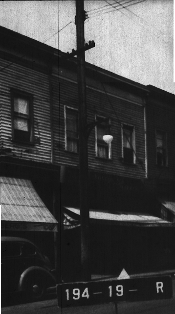
Looping back around the block, down State Street and around to Market Street, there are two more businesses (the first being a barbershop) and then a run of houses. 

A

B

C

D

E

F

G

Above location seen from same vantage point modern day

H

I

J

K

L

M

N

O

P

Q

R
S


Thursday, December 01, 2016

The West Brighton Projects Project: Part Three - Castleton Avenue between State and Broadway and Broadway between Castleton and Market

I'm a startled at my recent burst of energy regarding the various reconstructions I've started of several lost Staten Island neighborhoods. With each new post I've been reminded a little bit more about why I started this: documenting places that have been destroyed or damaged that are worth remembering. 

Staten Islanders talk a lot about the devastation wrought by development on the south shore, and while true, the north shore saw significant troubles as well. Whether it was the urban planners' deciding Stapleton's back streets were "blighted," or Port Richmond's stores falling prey to the Penny's Plaza, the north shore of the past is truly past. I believe it's worth documenting what that past looked like, if only to remind us, especially now as major development is taking place, that the Island's constantly changing. It's nothing new, it just needs to be handled with an eye toward not letting it look like garbage.

*************************************

The first two pictures are from the north side of Castleton Avenue between State Street and Broadway. You can see it was very similar to the surrounding stretches of Castleton: commercial spaces with apartments above. 

 NE corner of State and Castleton


NW corner of Castleton and Broadway

The remaining pictures are of the west side of Broadway between Castleton and Market Street. Off the main thoroughfare, we get something we've seen a lot of these posts, a heterogeneous mix of stores and housing. There was even an attached house on the corner of Market Street (#04).


The biggest, saddest thing I'm taking away from the projects projects is that existing neighborhoods were declared blighted. They were then wiped out and replaced with mono-zoned high density buildings. Now, fifty-five years later, these neighborhoods are far more blighted and run down than they were before the housing projects. It's almost as if the urban planners decided to corral as many poor people as possible into a single location and then forgot about them. 

Thursday, April 07, 2016

The West Brighton Projects Project: Part One - west side of State Street between Market and West Union Streets

While I haven't finished the Stapleton Projects Project yet, I was inspired to start this second Projects Project by a picture posted on Facebook the other day. It was of mass being celebrated in the old St. Benedicta Roman Catholic Church, one of the casualties of the construction of the West Brighton Projects in the early sixties.

I'm swiping the picture, but I highly recommend following this link to the original posting at FB. The poster and several commenters provide some valuable information about the lost neighborhood and the church.

Mass at St. Benedicta


original St. Benedicata ca. 1940 - corner of State and Market Streets


The part of West New Brighton destroyed was smaller than that which was razed in Stapleton. The residences were smaller, and so far, I haven't come across too many big multi-family buildings like in Stapleton. There isn't the commercial-residential mix here either as in Stapleton. The stores appear to have been mostly found out on Castleton Avenue and Broadway.